National Atlas of Hungary - Antecendents

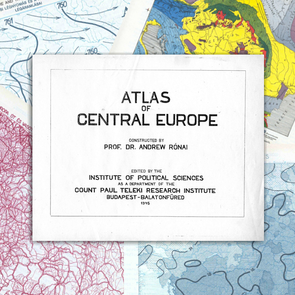
András Rónai (Ed.) 1945. Középeurópa Atlasz – Atlas of Central Europe. Államtudományi Intézet – Institute of Political Sciences, Budapest – Balatonfüred. (1945)
This work was edited by András Rónai, director of the Institute of Political Sciences, which is regarded as the organizational predecessor of the present Geographical Institute, Research Centre for Astronomy and Earth Sciences of the Hungarian Academy of Sciences. The atlas was published in Hungarian and English and it met all the requirements of a national atlas, with one exception: it did not show the territory of a country (Hungary) exclusively, but rather the area of Hungary, the Carpathian Basin and its broader environment on 134 colour maps at a scale of ca. 1:6.2 million on 334 pages. The English-language version of the atlas (31.5 x 23 cm in size) contained 171 maps on 367 pages. This masterpiece was originally prepared for the talks on the peace treaty after World War II, but later it was almost destroyed. Its digital facsimile version was published in Hungarian and in English on 411 pages by the Society of St. Steven and Püski Publishing House in 1993. The cartography work was mainly undertaken at the Department of Cartography of Eötvös Loránd University.
Book review: István Klinghammer: András Rónai: Atlas of Central Europe - a masterpiece of maps. (in Hungarian). Published in Földrajzi Értesítő (Geographical Bulletin) 57/1-2. 71-75. (2008) (PDF, ~230 KB)
Content
Click on the chapters to access the full text!
|
1-5. |
COVER PAGES, CONTENT (3 MB) | |
9. |
INTRODUCTION (1.4 MB) | |
12. |
THE PLACE OF CENTRAL EUROPE ON THE CONTINENT (0.6 MB) | |
14. |
DISTANCE FROM THE SHORE (0.8 MB) | |
16. |
CLIMATE-ZONES IN EUROPE (1.6 MB) | |
20. |
THE STRUCTURE OF CENTRAL EUROPE (1.7 MB) | |
22. |
GEOLOGICAL MAP OF CENTRAL EUROPE (1.2 MB) | |
24. |
RELIEF (2 MB) | |
28. |
RIVER-SYSTEM (0.8 MB) | |
30. |
FOREST-AREAS (1 MB) | |
32. |
SOILS (12 MB) | |
34. |
STATE BOUNDARIES (2.6 MB) | |
38. |
THE NOMINATION OF REGIONS (1.2 MB) | |
41. |
THE CLIMATIC MAPS OF CENTRAL EUROPE (16 MB) | |
42. |
January Atmospheric Pressure and the Prevailing Winds of Winter | |
44. |
July Atmospheric Pressure and the Prevailing Winds of Summer | |
46. |
The Mean Annual Temperature | |
48. |
The Mean January Temperature | |
50. |
The Mean July Temperature | |
52. |
Average values of extremites in the temperature | |
53. |
The amplitudo between the temperature of the warmest and coldest month | |
54. |
The Annual Course of Temperature | |
56. |
Number of Frosty Days | |
58. |
The amount of annual rainfall | |
60. |
The spring rainfall | |
61. |
The summer rainfall | |
62. |
The autumn rainfall | |
63. |
The winter rainfall | |
64. |
The Annual Course of rainfall | |
66. |
Humidity in January | |
67. |
Humidity in July | |
68. |
Sunlight | |
70. |
Precipitation and Clouds | |
72. |
ADMINISTRATIV DISTRICTS IN THE CARPATHIAN BASIN AND SURROUNDINGS ABOUT 1930 (0.5 MB) | |
73. |
AREA AND POPULATION (35.6 MB) | |
74. |
Density of Population | |
77. |
Distribution of Population | |
78. |
Maps With Regional Data | |
79. |
Population, Area and Population Density of Central Europe by Regions | |
81. |
Total Population, Area and Population Density by Large Regions | |
83. |
Development of Population in Large Cities between 1800-1940 | |
85. |
Nationalities | |
87. |
Nationality Majority over 50 per Cent | |
89. |
Nationality Majority above 75 per Cent | |
91. |
The Mixture of Nationalities | |
92. |
Pure Territories of the Nationalities in Central Europe | |
93. |
Homogeneous Nationality Territories | |
94. |
Minorities | |
97. |
Nationalities by Regions | |
98. |
The Germans | |
100. |
The Russians, Ukrainians and Ruthenians | |
102. |
The Italians | |
104. |
The Poles | |
106. |
The Hungarians | |
110. |
The Roumanians | |
94. |
Czechs, Moravians | |
112. |
The Czechs and Moravians | |
114. |
The Serbians | |
116. |
The Bulgarians | |
118. |
The Croatians | |
120. |
The Slovaks | |
122. |
The Slovenes /Vends/ | |
124. |
The Albanians | |
126. |
The Turks | |
128. |
The Bosnians | |
130. |
Gipsies | |
132. |
The Slavs | |
134. |
The Slavs and Their Natural Increase | |
136. |
THE SPREAD OF RELIGIONS (12.6 MB) | |
139. |
Religious Denominations | |
140. |
Roman Catholics | |
142. |
Greek Catholics | |
144. |
Protestants | |
146. |
Greek Orientals | |
148. |
Mohammedans | |
150. |
Israelites | |
153. |
Actual Numbers of Israelites | |
154. |
OCCUPATIONS (14.8 MB) | |
155. |
Occupational Distribution of Population in Central Europe by Regions | |
157. |
Occupational Distribution of Population by Large Regions | |
159. |
Agricultural Population in the Percentage of Total Population | |
160. |
Density of Agricultural Population | |
162. |
Mining and Industrial Population | |
164. |
Population Engaged in Trade and Transportation | |
166. |
Public Service and Free Professionals | |
168. |
The Rate of Illiterates | |
173. |
Western Christianity and Illiteracy | |
174. |
POPULATION MOVEMENT (15.2 MB) | |
176. |
The Rate of Live-Births | |
178. |
The Rate of Deaths | |
182. |
The Natural Increase of the Population in the Years About 1930 | |
184. |
The Chronological Development of the Rate of Natural Increase by Regions between 1920-1941 | |
186. |
Infant Mortality | |
188. |
Population Density and Natural Increase | |
191. |
The Distribution of the Population According to Age by Regions /1930/ | |
193. |
GENERAL ECONOMIC ACTIVITY (10.1 MB) | |
195. |
The Distribution of the Area by Branches of Cultivation | |
196. |
Arable Land | |
198. |
The Rate of Meadows and Pastures | |
200. |
Forest areas | |
206. |
PROPERTY CONDITIONS (46.4 MB) | |
210. |
The Acreage of Cereals and Potatoes by Regions | |
212. |
Wheat | |
214. |
The Average Yields of Wheat | |
216. |
The Amount of Wheat Production Compared to the Number of Population | |
218. |
Rye | |
220. |
The Average Yields of Rye | |
222. |
Production and Demand for Rye | |
224. |
Bread-grain Supply of Central Europe From Wheat and Rye | |
226. |
Barley | |
228. |
The Average Yields of Barley | |
230. |
The Per Capita Barley Production | |
232. |
Oats | |
234. |
The Average Yields of Oat | |
236. |
Per Capita Amoumt of Oats | |
238. |
Corn | |
240. |
The Average Yields of Corn | |
242. |
Per Capita Amount of Corn | |
244. |
Potatoes | |
246. |
The Average Yields of Potatoes | |
248. |
Per Capita Amount of Potatoes | |
250. |
Per Capita Amount of Cereals and Bread-crops Combined | |
252. |
Per Capita Amount of the Various Products of Cereals by Regions | |
254. |
Excess and Want in Cereals and Potatoes by Regions | |
256. |
Non-agricultural Population | |
258. |
Production and Needs in Bread-grains and Potatoes by Regions | |
260. |
Production of Other Plants | |
263. |
LIVESTOCK-RAISING (20.2 MB) | |
268. |
The Stock of Horses | |
270. |
The Cattle Stock | |
272. |
Per Capita Amount of Beef about 1935 | |
274. |
The Stock os Swines | |
276. |
Per Capita Amount of Pork /1935/ | |
278. |
Per Capita Amount of Fats /1935/ | |
280. |
The Stock of Sheep | |
282. |
Per Capita Amount of Mutton /1935/ | |
284. |
The Available Total Amount of Meet by Head /about 1935/ | |
286. |
Surplus and Deficiency in Meat per Regions | |
288. |
The Available Amount of Meat, Surplus and Deficiency per Regions | |
291. |
MINING (14.3 MB) | |
294. |
Coal Reserves of Central Europe | |
296. |
Production of Coal and Carbonic Hydrogene of Central Europe | |
296. |
Production of Anthracite | |
297. |
Production of Carbonic Hydrogene in 1938 | |
300. |
Ore Reserves of Central Europe | |
306. |
Iron-, Steel Refining-, Copper- and Aluminium Ore Production of Central Europe between 1928 and 1938 | |
309. |
Production of Salt, Mottled Ore and Other Useful Minerals between 1927-1938 | |
314. |
HEAVY INDUSTRY (2.4 MB) | |
319. |
SYSTEM OF ROADS AND RAILWAYS (2.9 MB) | |
323. |
THE ACCESSIBILITY OF THE CENTRAL EUROPEAN AREA FROM THE NEIGHBOURING LARGE CITIES. SOME IMPORTANT ROUTES (3.6 MB) | |
328. |
PASSENGER AND FREIGHT TRAFFIC, AND TRANSPORTATION ROUTES (1.6 MB) | |
331. |
PRINCIPAL TRANSVERSAL TRANSPORTATION ROUTES (0.6 MB) | |
332. |
ISOCHRONE MAP OF THE MORE IMPORTANT CITIES OF CENTRAL EUROPE (1.6 MB) | |
334. |
AIRWAYS ABOUT 1935 (1.2 MB) | |
336. |
RADIO STATIONS BETWEEN 1937-1941 (1.3 MB) | |
336. |
FOREIGN TRADE (6.4 MB) | |
353. |
BOUNDARIES OF COUNTRIES, PROVINCES AND COUNTIES (9.8 MB) | |
355. |
Boundaries of Countries, Provinces and Counties in 1910 | |
356. |
Boundaries of Countries, Provinces and Counties in 1930 | |
361. |
Names of Countries, Provinces and Counties in 1930 | |
362. |
Boundaries of Countries, Provinces and Counties in 1942 | |
364. |
The Territorial Development of Some Important Empires in Central Europe and in the Surrounding Areas | |
366. |
Stability of State Boundaries in Central Europe | |

